From pre-European settlement to the present day, Wareham’s history and development patterns have been determined by opportunities presented from the use of its river and ocean resources and the marshes and uplands that surround them. Wareham has always benefited from its situation at the head of Buzzards Bay where the Agawam and Wankinco Rivers join to form the Wareham River, and from its 57 miles of coastline.
1620 – 1775
The native population retained legal ownership of present-day Wareham until the late-17th century, and utilized the area’s rivers and tidelands for seasonal subsistence. The advent of significant white settlement dates to the conclusion of King Phillip’s War (1675-6), although there is evidence of prior use of Wareham land by overseers based in Plymouth for seasonal use. The public center of Wareham was located around Center Park, then known as Fresh Meadows. Early settlement also centered around Agawam Cemetery on Great Neck, with additional settlements in South Wareham at the junction of the Weweantic River and Mary’s Pond Road. These areas saw continued development through the 18th century. The northeast section of present-day Wareham was largely uninhabited at this time. An economic base was established during this period consisting of agriculture, husbandry, fishing, and light industry, with white settlers gradually disrupting native subsistence patterns. Wareham’s oldest extant house dates to this period, the Burgess House (c. 1680 or c. 1709) on Great Neck Road. Other surviving colonial houses from this period are found along Elm Street, Lincoln Hill and Great Neck Road. The Town of Wareham was officially established on July 10, 1739. Wareham’s territory at that time was created by combining land from Rochester, then known as the Sippican Grants, and from the Agawam Purchase, land that had been leased and then purchased from the Plymouth Proprietors in the late-17th century.
1776 – 1830
From the late-18th into the early-19th century, Wareham’s population grew from under 1,000 to almost 2,000 inhabitants as local manufacturing increased, and as Wareham itself grew in 1827 when Wareham annexed parts of Carver and Plymouth and expanded to its present-day boundary. Wareham’s 19th century economic development was dominated by iron-related manufacturing and maritime industries such as shipbuilding, whaling and fishing, and salt production. Wareham was well suited for such development due to a combination of excellent waterpower from the Weweantic, Wankinco, and Agawam Rivers, plentiful bog iron, access to big timber, and protected coastal outlets for trade in iron ore and iron products and other maritime activities. The production of nails and holloware played a large part in Wareham’s economy, beginning in 1819, with rolling mills established by Isaac and Jared Pratt at the present Tremont Nail Factory on the Wankinco, a plant in Tihonet made accessible to tidewaters by a series of canals, the Washington Iron Works on the Weweantic in West Wareham, and a nail factory on the Weweantic in South Wareham. Residential development during the early-19th century was concentrated along major roads such as Elm Street, and on Main and High Streets in the town center. In addition, more modest cottages and worker housing, including double cottages, were constructed, many associated with and in proximity to industrial centers.

1830 – 1870
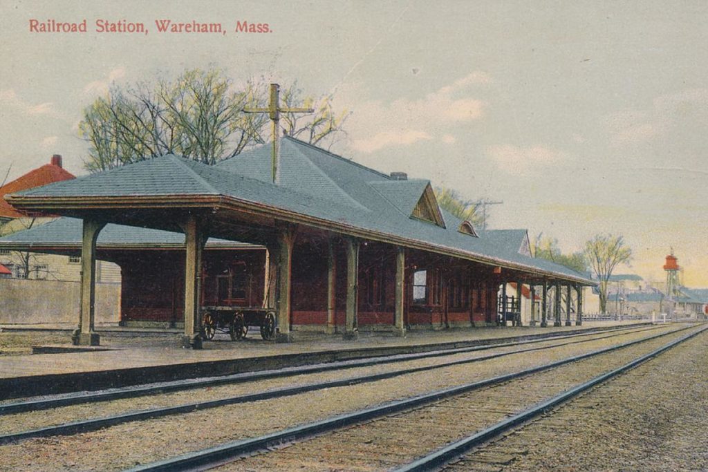
By the mid-19th century, transportation corridors were improved, including the Sandwich Railroad in 1847 which went through West Wareham, Wareham Center, and East Wareham, with a bridge over the Narrows, which had formerly been served by a ferry. The nail industry reached its peak during this period, as did whaling, and cod and mackerel fisheries. The overall population continued to grow, reaching a 19th century peak, including a large foreign born population, mostly from Ireland. Wareham Historical Commission Wareham Preservation Plan 2007 Residential development of modest cottages continued in the villages of Wareham, with more elaborate examples including large Greek Revival and Italianate houses in Wareham Center, representing the industrial prosperity of the period.

1870 – 1915
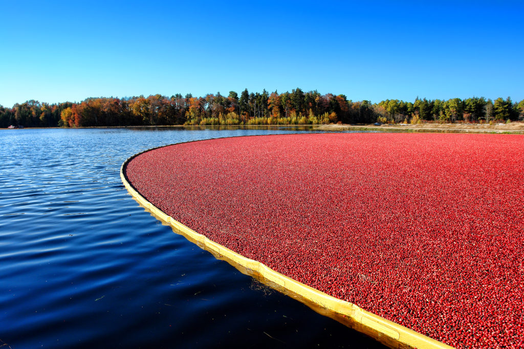
Manufacturing, including nails and horseshoes, continued on a more limited basis into the early 20th century, but two new industries emerged at this time, summer tourism and cranberry growing, which would transform elements of Wareham’s landscape. Significant tourism first developed in the form of planned summer communities, most famously the Onset Bay Grove Association, initially founded in the 1870s as a Spiritualist camp-meeting site, and growing into a popular planned summer community of over 1,000 small lots interspersed with communal parks and beaches. Houses were modest Gothic Revival, Stick, and Queen Anne cottages with commercial development around Onset Avenue. The railroad played an important role in the development of Onset as a vacation area, as did a trolley service for local transportation. While coastal areas saw increased residential development, Wareham’s lowlands were being transformed into productive cranberry bogs as the cranberry industry grew into a powerful economic force. One of the earliest known bogs was constructed on White Island, c. 1860, and by the turn-of-the-century when the United Cranberry Company was formed there were 37 growers listed in the town directory, and that number continued to grow. In addition to the bogs themselves, associated industries were developed such as cranberry equipment manufacturing and cranberry preserving.
1915 – 1950
The period after WWI was marked by continued development of summer colonies and planned communities, and a steady increase in year-round population with new in-fill housing in already settled areas. Mass production of the automobile lead to improvement of transportation routes, including upgrades to Route 28 and Cape Cod-New Bedford Highway (Route 6). Economically, cranberry growing continued to mature into a major industry, and construction of the Ocean Spray Cranberry plant on Sandwich Road making Wareham a major distribution center for cranberries. The iron-based and maritime-related industries continued but saw a steady decline due to new technologies and cheaper labor and materials elsewhere.

1950 – Present
The greatest 20th century population increase took place after WWII. Over 2/3 of Wareham’s housing has been built since 1950, some following existing settlement patterns and others in new subdivisions and developments. Today there are approximately 12,000 housing units in Wareham, of which 1/3 are seasonal. The Cranberry Highway emerged as a major retail corridor in the 1950s, reaching it peak in the 1970s as Cape-bound traffic was required to pass though this commercial zone of Route 6. However, the construction of Routes 495/25 bypass and 195 have greatly reduced non-local traffic and business activity. While Wareham’s economic base has shifted to service industries, cranberry growing remains an important economic factor, and cranberry growers control over 30% of Wareham’s 29,940 acres of land. Important reminders of Wareham’s industrial and maritime roots survive, including the Tremont Nail Factory and the Cape Cod Ship Building Company; and neighborhoods throughout Wareham reflect its layered history from Onset Village’s Wigwam and many extant Victorian-era cottages to the high-style residences in Wareham Center, and from the rural 18th and 19th century streetscapes of Great Neck and County Roads to the many 20th century planned seasonal communities.
Source Document: Wareham Historical Commission – Wareham Preservation Plan 200


